Latitude 50°34'40"N Longitude 3°31'50"W


ACQUISITION

Transferred from Air Ministry


OPENED


COMMISSIONED

18 August 1941


PAID OFF

As 'Heron II' 31 December 1942, but remained as satellite to Yeovilton accounts being borne on 'books of HERON'.


CLOSED

To Care & Maintenance May 1943, closed 17 February 1946


FUNCTION

Relief landing ground and satellite to RNAS Yeovilton, Refuelling for Air Towed Target aircraft using Lyme Bay, A.T.C. Glider training (84 Gliding School).


ADDRESS

R.N. Air Station,

Hakdon,

Nr Bishopsteignton,

Devon,

England


LOCALITY

The airfield is situated at Little Haldon, 2 miles N.W. of Tefignmouth, and 3¼ miles N.E. of Mewton Abbot.

Torquay lies 6 miles S. and Exeter 8 miles N.

Exmouth lies 5 miles N.E. by E.


LANDMARKS

The river Exe, with with the town of Exmouth at tits E. entrance point. The river Teign, with Tieigmouth at its N. entrance point.

Five toads converge on, and enclose. the airfield; a wood adjoins its N. boundary ad extends 1¼ miles eastward.

ROAD AND RAIL ACCESS

Direct access at the main Teignmouth-Exeter road.

A secondary road, running E.W. from he airfield, joins the main Newton Abbot-Teignmouth toad. 2 miles distant. Railway station at Tiegnmouth. on the G.W.R. Newton Abbot-Exeter line.


CONTROL

No permanent facilities.


SIGNALS.

Ground signals area at E. side of sheds.


ELEVATION

770' above M.S.L.


RUNWAYS /LANDING AREA

Irregular grass surface;


N./S., 950 yds.  N.E./S.W, 1000 yds.


There are three lading strips outlined at their ends and intersections white gravel markings.


00/18 - QDM. 002°/182° .... 900 X 145 yds.

05/23 - QDM. 047°/227° .... 695 X 150  yds.

14/32 - QDM. 137°/317° .... 500 X 150  yds.


Some Somerfield tracking may have been laid in 1942.


TRACKS

None.


OBSTRUCTIONS

Navigation:

None, the airfield lies near the summit of Little Haldon ridge.

Approach:

None.


APPROACH

Not known 


WIND INDICATOR

Windsock near Golf Clubhouse at the S. end  of the airfield.


HOMING - VISUAL

By day:

By night:

None.

None.


HOMING--RADIO

D/F: Beacon:


None.

None.

APPROACH - VISUAL

By day:  

By night:  

None.
None.


APPROACH - RADIO

None.


NIGHT FLYING..

No facilities.


COMMUNICATION EQUIPMENT

None.

GROUND RADAR

None.


ACCOMMODATION

No accommodation for personnel. Local houses are requisitioned as necessary. Nissen hut at S end of airfield used as a crew room.

Nearby Haldon Camp was taken over in April 1942 to provide additional accommodation.


ARMOURIES

None.


COMPASS BASE

None.


DISPERSAL

One macadam hard standing.


HANGARS

None.


MEDICAL

None.


METEOROLOGICAL

Phone R.N.A.S, Yeovilton.


FUEL AND OIL

Aviation:

5,000 gallon storage tank.

M/T:

Three 500 gallon tanks.

Oil :

Storage room for 40-gallon drums in main shed.


TEST BASE

None.


TEST BUTT

None.


WORKSHOPS

None. Stores shed at S. end of airfield.


EXPLOSIVES.

Ammunition store in Nissen hut at the S. end of the airfield.


BOMBING AND FIRING RANGES

None.


Information taken from CB 4368 B. Admiralty Handbook of Naval Air Stations Aug. 45


List of first and second line squadrons, station flight and other flying units based at this location


There were no resident units but regular use was made by these units:


759

Fleet Fighter School and Pool Squadron.

Detachments of aircraft, including Fulmar Martlet, Spitfire & Sea Hurricane from RNAS Yeovilton used the station during periods of live firing practice on the Lyme Bay live firing ranges. This squadron also operated Sea Gladiator,, Master & Proctor which may have visited the station on navigation exercises and ferry trips.


761

Advanced Training Squadron, part of the Fleet Fighter School at RNAS Yeovilton

Detachments of Fulmars & Sea Hurricanes from RNAS Yeovilton used the station during periods of live firing practice on the Lyme Bay live firing ranges.


794

Air Towed Target Unit.

Detachments from RNAS Yeovilton frequented the station which served as a refuelling base for target towing aircraft operating over the Lyme Bay live firing ranges. Aircraft types included Defiant, Roc, Skua, Swordfish,  & Spitfire.


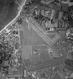
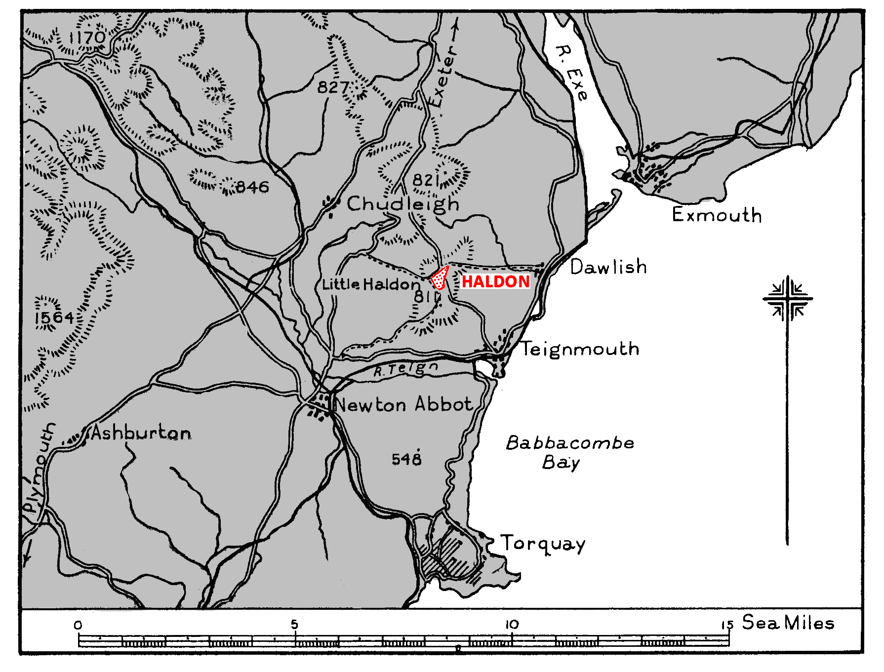
Originally opened in September 1929 as a civil aerodrome situated on open moorland at Little Haldon, Haldon was requisitioned by the Air Ministry shortly after the start of 
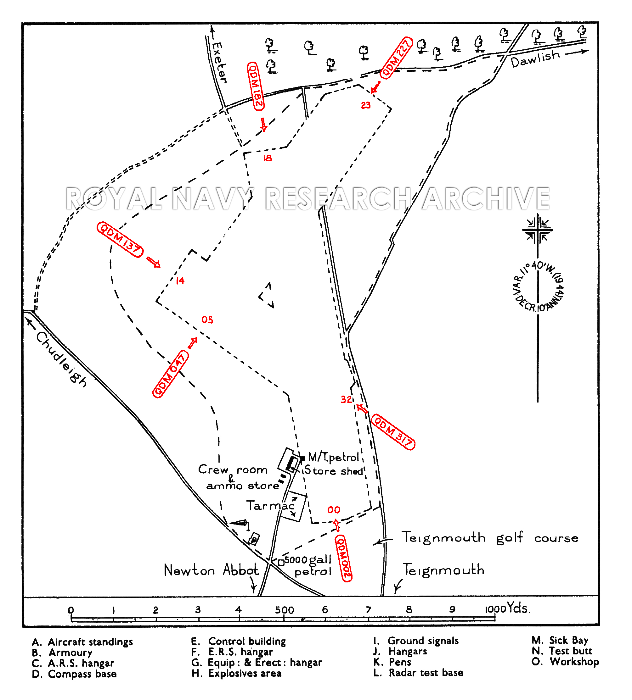
World War Two. This was a very small aerodrome, the landing area was approximately 900 X 145 yards oriented N/S, one hanger is known to have been built on the site but this is not marked on military plans of the airfield (but may described as a storage shed).

The airfield was extended by the requisitioning of land to the north and south, this expansion resulted in the landing areas cutting across two roads the in the south evolved taking over a small portion of the Teignmouth golf course. 
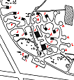
Two Nissen huts were added, one for use as a crew room the other an ammunition store. A 5,000 gallon storage tank was provided for aviation petrol along with three 500 gallon tanks for M/T petrol. There was no control tower but ground signals were laid out in an area east of the sheds, Visual flying rules applied, communications would be via aldis lamp signals and arrangements for refuelling would be telephoned from Yeovilton in advance. There were no night flying facilities. Accommodation for the airfield guard was provided by the acquisition of Haldon Tea House while other billets where found for personnel in Haldon and Teignmouth.


RN use of the airfield

The RAF made little use of the field, the Research Development Flight, from RAF Boscombe Down , engaged in developing balloon cable cutters and airfield rocket defences, arrived to make use of the facilities and communications aircraft from Boscombe Down used the field while armament trials were conducted on the Lyme Bay ranges. The airfield was transferred to the Admiralty in August 1941 as a Relief Landing Ground and tender to RNAS Yeovilton. The station was commissioned as HMS HERON II on August18th.

The main role for RNAS Haldon was that of a relief landing ground and a refuelling stop for Air Towed Target aircraft operating from Yeovilton; these aircraft provided targets for ships in the Lyme Bay area and air-to-air live firing practice for pilots from the Fleet Fighter School (759 7 761 squadrons) flying from RNAS Yeovilton.

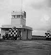
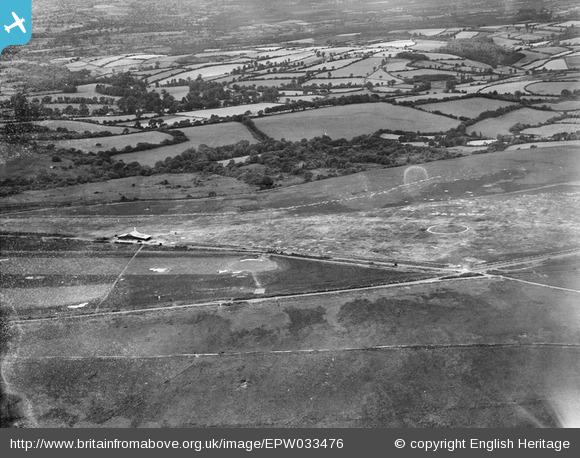
Operations from the aerodrome proved very difficult, there were few permanent buildings and the grass surface was poorly drained; work began in 1942 to improve the drainage and install a tarmac hard standing, and some areas of the field had sections of Somerfield pierced steel tracking laid. In April of that year the near by Haldon Army Camp was released by the War Office and the Admiralty took charge of the facilities as additional accommodation; it is unclear as to whether any use was actually made of the camp.

On December 31st 1942 the station's status was changed when it lost its commissioned name; the newly acquired station at Charlton Hawthorne became H.M.S. HERON II from knew Year's Day 1943. From this date the station was carried 'on the books of HERON'. Four months later the station was slated for closure and it was reduced to Care & Maintenance status in May 1943.

During August 1944 the RAF established No. 84 Gliding School at Haldon, equipped with a Dagling Primary, 3 Cadets and a Sedbergh.


Post War use and closure

The Admiralty officially closed and paid off RNAS Haldon on February 17th 1946. The Gilding School left for Exeter in June 1946 and was the last military flying unit to operate from the site.


Click here for a list of Primary sources


Additional sources:

The Airfield Information Exchange - AiX ARG. 2012. Haldon. [ONLINE] Available at: http://www.airfieldinformationexchange.org/community/showthread.php?1537-Haldon-Teignmouth-HMS-Heron-II&highlight=Haldon. [Accessed 15 November 13].


DEVON AIRFIELDS. 2013. HALDON Teignmouth Aerodrome. [ONLINE] Available at: http://devonairfields.hampshireairfields.co.uk/hald.html. [Accessed 15 November 13].


Britain from Above . 2013. The Haldon Aerodrome, Little Haldon. [ONLINE] Available at: http://www.britainfromabove.org.uk/image/epw0334766. [Accessed 15 November 13].


View Larger Map


The Haldon Aerodrome, Little Haldon 1930 www.britainfromabove.org.uk/image/epw033476


Add Comment

* Required information
1000
What is the sum of 1 + 2 + 3?
Captcha Image
Powered by Commentics

Comments (0)

No comments yet. Be the first!