| |
|
|
|
|
ACQUISITION |
|
|
COMMISSIONED |
1.10.1940 as 'JACKDAW'
29.4.1947 as 'BRUCE'
26.10.1949 as 'JACKDAW'
|
|
CLOSED |
|
|
PAID OFF |
'JACKDAW' 28.4.1947
'BRUCE' 25.10.49 |
|
|
|
|
C.O./O.I.C. |
|
|
|
|
|
FUNCTION |
Torpedo Trading School
T.B.R. Operational Training
Unit
770 Fleet Requirements unit.
Mobile Air Torpedo Unit No.1
Accommodation for disembarked front-line squadrons.
Loaned as Boys training establishment 1947-49 the
Reserve airfield until at least 1960.
|
|
ADDRESS |
R.N. Air Station, Crail,
Fifeshire,
Scotland.
|
|
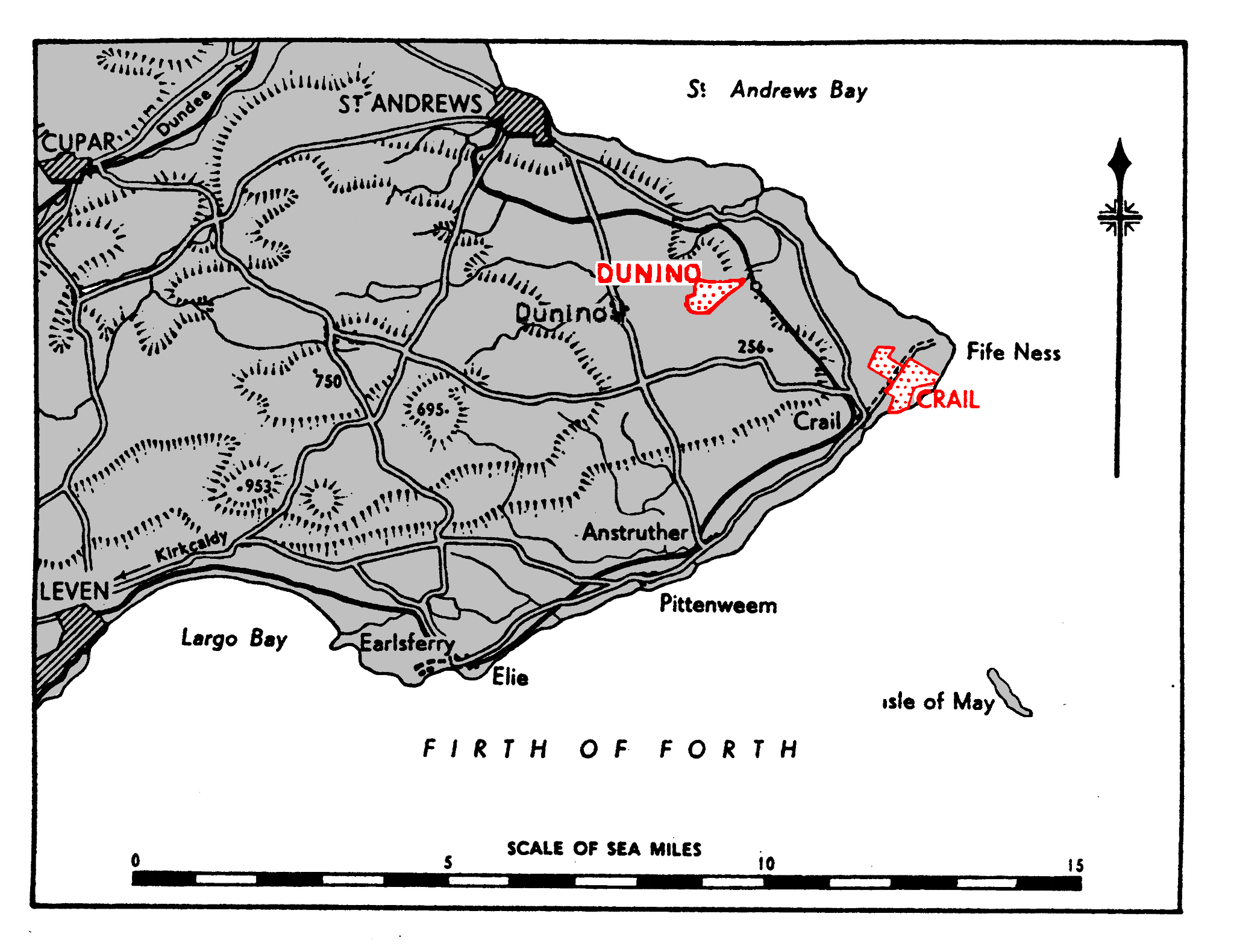
LOCALITY
|
The airfield lies on the coast, ¾mile
SW. of Fife Ness, the N. entrance point of the Firth of
Forth, and ½mile NE. of the
coastal village of Crail. St. Andrews lies 72 miles NW.
by W.
Edinburgh lies 27 miles SW. on the S. side of the Firth
of Forth.
|
|
LANDMARKS |
The Firth of Forth, with the Isle of May lying 5 miles SSE.
of the airfield.
|
|
ROAD AND RAIL ACCESS |
A secondary road from Fife Ness traverses the airfield, and
leads SW. to Crail railway station, distant 1½
miles (R) on the S.R.
|
|
|
|
|
| |
|
|
|
|
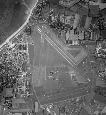
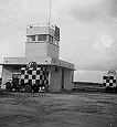
CONTROL |
Control building on the W. side of the landing area,
inside the perimeter track.
|
|
ELEVATION |
75 ' above M.S.L. |
|
RUNWAYS |
Four, tarmac
Extensibility
03/21 QDM. 029°-209° .. 1000 x 33 yds. -
07/25 QDM. o67°-247° .. 120o x 33 yds. *17oo
yds.
12/30 QDM. 117°-297° .. moo x 33 yds.
-
16/34 QDM. 157°-337° .. 1000 x 33 yds.
-
*Runway extension not recommended
|
|
TRACKS |
All runways are connected to the main hangar area by 40'
track. Complete perimeter track.
|
|
OBSTRUCTIONS |
Navigation |
None. |
|
Circuit & |
Crail Church, distant goo yds. from runway 07/25 on
approach QDM. 067°.
Pittowie Plantation distant 1250 yds. 282, and Balcomie
Castle, distant 86o yds. 354, respectively, from the
control building.
|
|
Approach |
|
APPROACH |
Recommended sector, mean QDM. :
|
|
WIND INDICATOR |
Mot Known |
|
|
|
|
 |
|
|
|
|
HOMING - VISUAL |
By day |
None. |
|
By night |
None. |
|
HOMING--RADIO |
D/F |
|
|
Beacons |
|
|
APPROACH - VISUAL |
By day |
None. |
|
By night |
|
|
APPROACH - RADIO |
|
|
COMMUNICATION EQUIPMENT |
M/F & H/F |
Not known. |
|
VH/F |
|
|
|
|
GROUND RADAR |
Not known.
|
|
|
|
|
| |
|
|
|
|
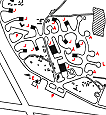
ACCOMMODATION |
Officers and ratings living quarters on W. side of the
airfield.
Capacity:
|
Officers: |
197 |
|
Chiefs, P.O.s and ratings: |
952 |
|
W.R.N.S. Officers: |
13 |
|
W.R.N.S. Chiefs, P.O.s and ratings; |
148 |
|
|
ARMOURIES |
|
|
COMPASS BASE |
Two, diameter 70'.
|
|
DISPERSAL |
Areas to NW. and NE. served by 40' tracks leading off
the perimeter track. Three aprons.
|
|
HANGARS |
Main area on NW. side of the airfield, reserve hangars
on the E.
|
Number /Type |
Size |
Door Height |
Door Width |
|
7 Bellman |
187½' x 105' |
25' |
105' |
|
1 A.R.S. |
25o' X 110' |
25' |
1I0' |
|
|
|
|
MEDICAL |
|
|
METEOROLOGICAL |
|
|
FUEL AND OIL |
|
Aviation: |
Not known. |
|
M/T: |
Not known. |
|
Oil : |
Not known. |
|
|
|
|
|
TEST BASE |
A/c Radar base available.
|
|
TEST BUTT |
M.G. test butt N. of main hangar area.
|
|
WORKSHOPS |
On the W. side of the landing area. Workshops to 4-6
Squadron scale.
|
|
VISITORS |
|
|
EXPLOSIVES |
|
|
BOMBING AND FIRING RANGES
|
|
|
Air to air |
|
|
Air to ground and R. p. Firing |
|
|
Live and practice bombing |
|
|
Practice bombing |
|
|
Assault training |
|
|
|
|
|
|
|
|
Information taken from CB 4368 B. Admiralty Handbook
of Naval Air Stations Aug. 45 |
|
 |
List of first and second line squadrons, station
flight and other flying units based at this location |
|
|
|
|
711
|
|
|
747
|
|
|
758
|
|
|
770
|
|
|
778
|
|
|
780
|
|
|
785
|
|
|
786
|
|
|
800 |
|
|
810 |
|
|
811 |
|
|
812 |
|
|
816 |
|
|
817 |
|
|
819 |
|
|
820 |
|
|
822 |
|
|
823 |
|
|
826 |
|
|
827 |
|
|
828 |
|
|
829 |
|
|
831 |
|
|
832 |
|
|
833 |
|
|
834 |
|
|
836 |
|
|
837 |
|
|
846 |
|
 |
|
PAGE UNDER
CONSTRUCTION
Click here for a list of
Primary sources
Additional sources:
|
|
|
| |
|
|
|
|


Comments (0)