| |
|
|
|
|
ACQUISITION |
200 acre site purchased by the Admiralty in March 1940.
|
|
OPENED |
March 1940
|
|
COMMISSIONED |
As H.M.S. VULTURE II 10.08.1940 |
|
CLOSED |
December 1955 |
|
PAID OFF |
31.12.1953 when VULTURE paid off. |
|
C.O./O.I.C. |
|
|
|
|
|
FUNCTION |
Emergency landing ground for aircraft using ranges.
Land Range with marking facilities open all year
round. R.P., D.B., A.G
Satellite to R.N.A.S. St. Merryn.
|
|
ADDRESS |
R.N. Emergency Landing Ground
Treligga,
Cornwall
|
|
LOCALITY
|
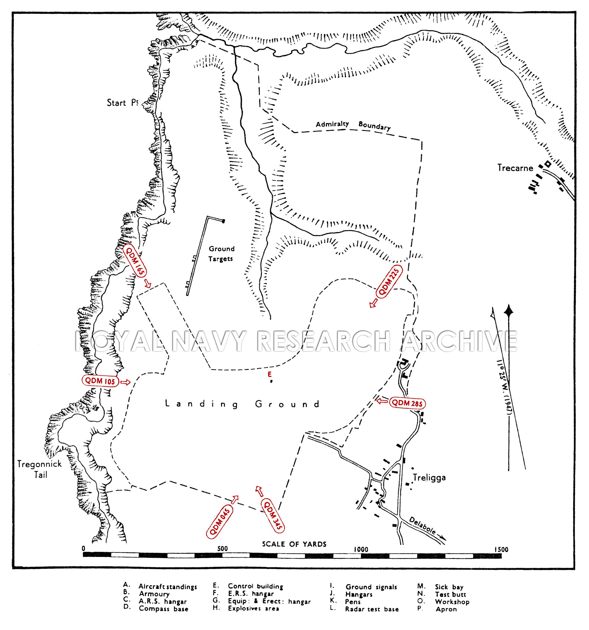
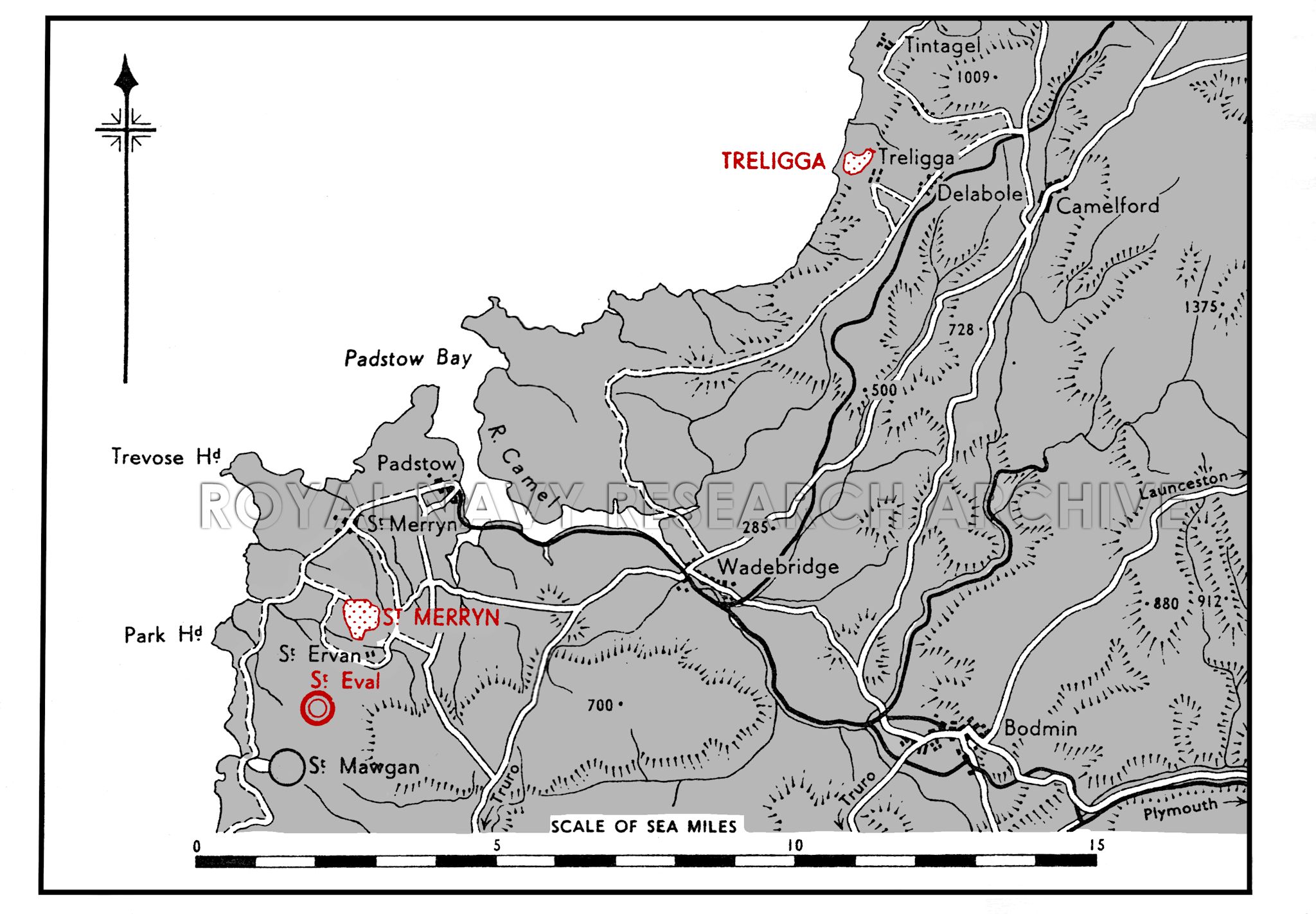
The landing ground lies on the coast 2½ miles S. of
Tintagel Head, 1½ miles WNW. of the village of Delabole,
and adjacent NW. of the village of Treligga.
Launceston lies 15 miles E. and Bodmin 10 miles SSE.
R.N.A.S., St. Merryn, lies 11 miles SW.
|
|
LANDMARKS |
The River Camel flowing into Padstow Bay, 7 miles WSW.
Tintagel Head.
A small ravine runs from the N. side of the landing ground
to the coast between Start and Dennis points close
northward.
|
|
ROAD AND RAIL ACCESS |
A secondary road running SSE. from the landing ground
connects with the main Bodmin-Launceston road.
Access to Delabole station, 2¾ miles (R), on the Southern
Region to Launceston.
|
|
|
|
|
| |
|
|
|
|
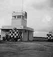
CONTROL |
No permanent facilities. There is a control hut on the
N. side.
|
|
ELEVATION |
350' above M.S.L.
|
|
RUNWAYS |
None.
|
|
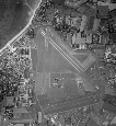
LANDING AREA |
Grass surfaced with three usable strips.
Q.D.M. 045°-225° . . 700 X 100 yds.
Q.D.M. 105°-285° .. 730 x 100 yds
Q.D.M. 165°-345° .. 800 x 100 yds.
|
|
TRACKS |
None.
|
|
OBSTRUCTIONS |
Navigation |
Land rises to 660' above landing ground within 2j miles
NE. |
|
Circuit |
None. |
|
Approach |
The land rises 200' within 500 yds. E.
The approaches from N., S. and seaward are clear.
|
|
APPROACH |
Recommended sector, mean QDM .
|
|
WIND INDICATOR |
Not known. |
|
|
|
|
 |
|
|
|
|
HOMING - VISUAL |
By day |
None. |
|
By night |
None. |
|
HOMING--RADIO |
D/F |
Mome. |
|
Beacons |
|
|
APPROACH - VISUAL |
By day |
None. |
|
By night |
None. |
|
APPROACH - RADIO |
|
|
COMMUNICATION EQUIPMENT |
M/F & H/F |
transmitters, receivers. |
|
VH/F |
transmitters, receivers. |
|
|
|
|
GROUND RADAR |
None.
|
|
|
|
|
| |
|
|
|
|
ACCOMMODATION |
A living hut on the E. side of the landing ground;
otherwise there are no permanent facilities.
Accommodation for 20 W.R.N.S. personnel at Port Isaac.
Capacity:
|
Officers: |
Not known. |
|
Chiefs, P.O.s and ratings: |
Not known. |
|
W.R.N.S. Officers: |
1? |
|
W.R.N.S. Chiefs, P.O.s and ratings; |
20 |
|
|
ARMOURIES |
None.
|
|
COMPASS BASE |
None.
|
|
DISPERSAL |
None.
|
|
HANGARS |
None.
|
|
MEDICAL |
None.
|
|
METEOROLOGICAL |
Phone R.N.A.S., St. Merryn, for meteorological
information.
|
|
FUEL AND OIL |
Aviation - |
|
|
M/T - |
|
|
Oil - |
|
|
TEST BASE |
None.
|
|
TEST BUTT |
None.
|
|
WORKSHOPS |
None.
|
|
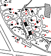
BOMBING AND FIRING RANGES
|
Ground targets are situated near the cliffs on the N.
side of the landing area. Range with marking facilities
open all year round. |
|
Air to Ground |
Yes. |
|
R. p. Firing |
Yes. |
|
Dive bombing |
Yes. |
|
|
|
|
Information taken from B.R. 1807 Admiralty Handbook
of Naval Air Stations Dec. 48 |
|
 |
List of first and second line squadrons, station
flight and other flying units based at this location |
|
|
|
|
|
No squadron s operated from this station, landing
area intended for 'Wheels-up' emergency landing use
only. |
|
|
|
|
 |
|
PAGE UNDER
CONSTRUCTION
Click here for a list of
Primary sources
Additional sources:
Admiralty Fleet Orders:
Confidential Admiralty Fleet Orders:
|
|
|
| |
|
|
|


Comments (1)
All fascinating information as I live in Padstow and had an elderly friend -since died-who was an Engineer Officer at St.Merryn after University,at the end of WW11 ... the air would have been filled with the sound of Merlins and the rumble of 'round engines'!